Tolima volcano Expedition
Nevado del Tolima
Live a unique mountaineering experience by climbing Nevado del Tolima (5,220m), one of Colombia’s most imposing volcanoes.
#Climb tolima-volcano.
Day 1.
Total Distance: 17km
Estimate time: 7-8 hours
Altitud gain: 2400m – 3800m – 3700m
Distance to Estrella de agua: 7km. / Time: 4 hours
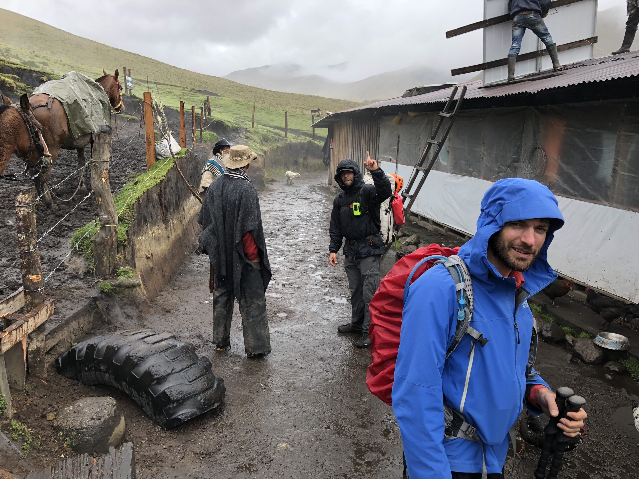
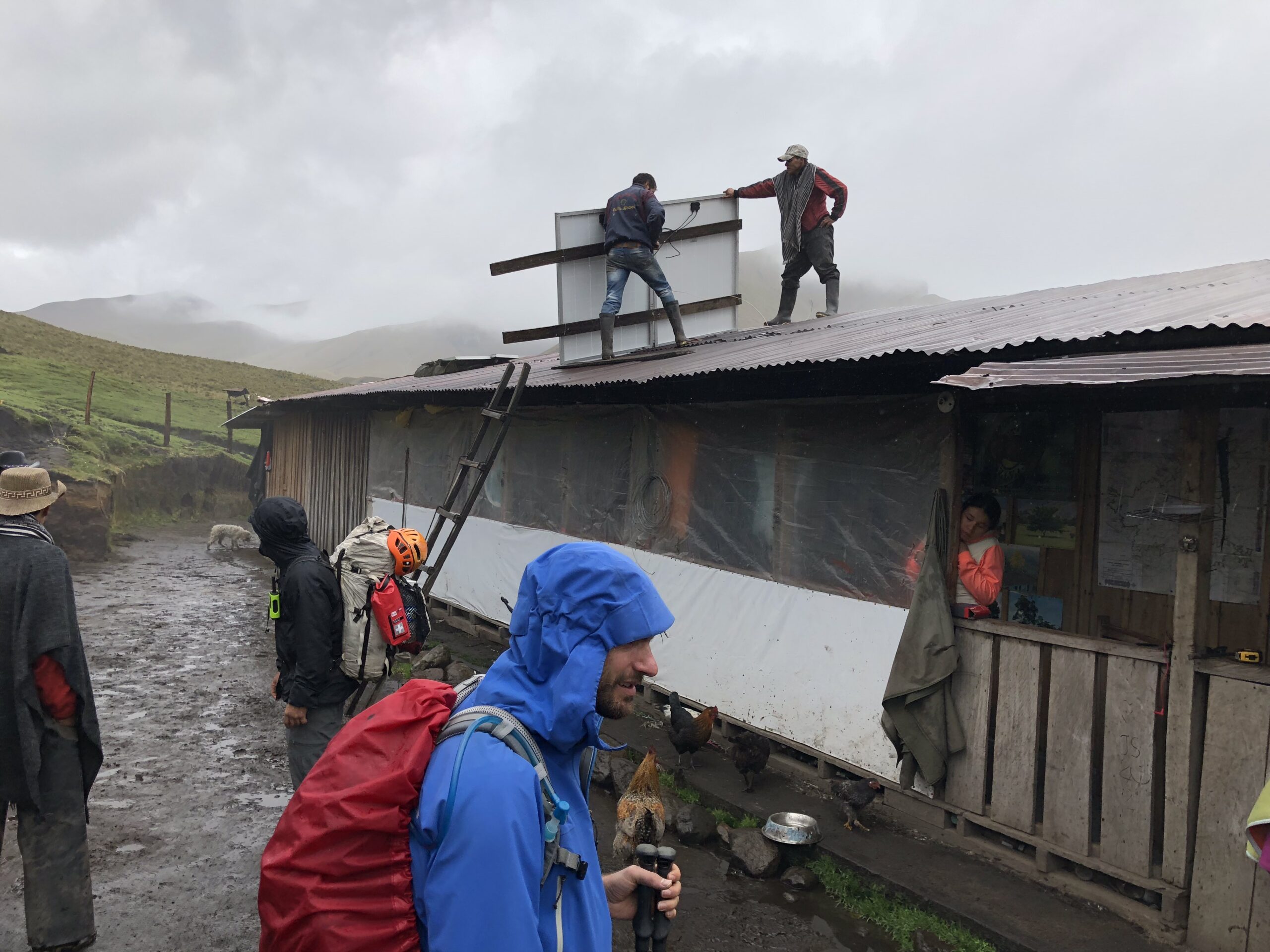
Hike from Cocora Valley through the “San jose” creek to “Estrella de agua”, biological station located at 3,170m (10,400ft); home of 96 species of Birds and mammals as the uncommon Spectacled Bear, Mountain tapir and much more; enjoy lunch on a traditional wood stove with Doña Ludivia, Don Carlos and their son “Juancho”, whom are doing what they love for this place, maintain the tracks and have them in perfect conditions.
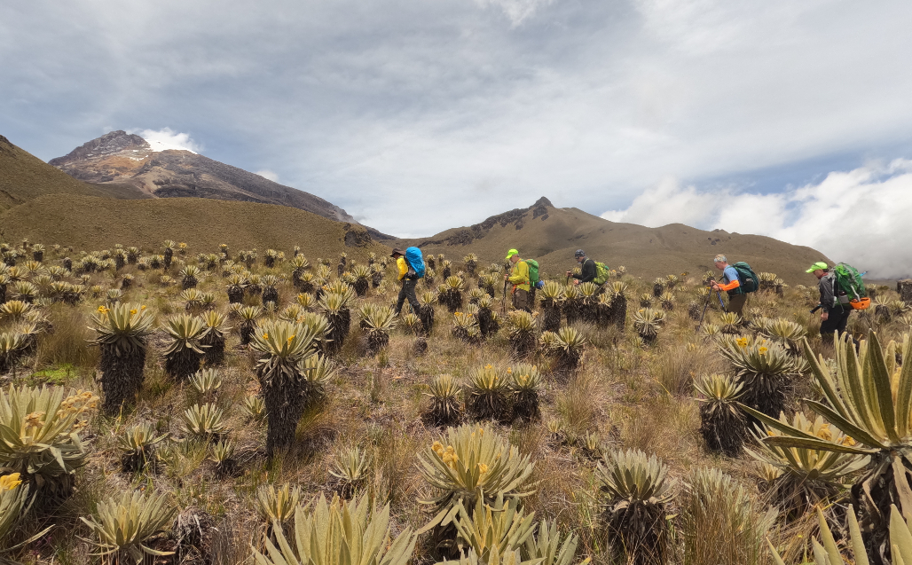
Then continue for another 2km inside the humid high Andean forest, this will be the toughest, steepest and muddiest part, until páramo ecosystem at 3,600m (11,811 ft); at this point you will be stock with awe for the quick changes in vegetation; 15min for a quick rest and to get ready for the final push, another 200m (656 ft) to get the highest point for the first day, 3,800m (12,467 ft). Along the ridge of “la virgen ridge” we will hike 5km more, with the views of the two sides of the inter andean valleys; the towering Tolima volcano and the massive Quindio volcano.
Day 2.
Total Distance: 20km
Estimate time: 11 – 12 hours
Altitud gain: 3700m – 5220 – 3700m
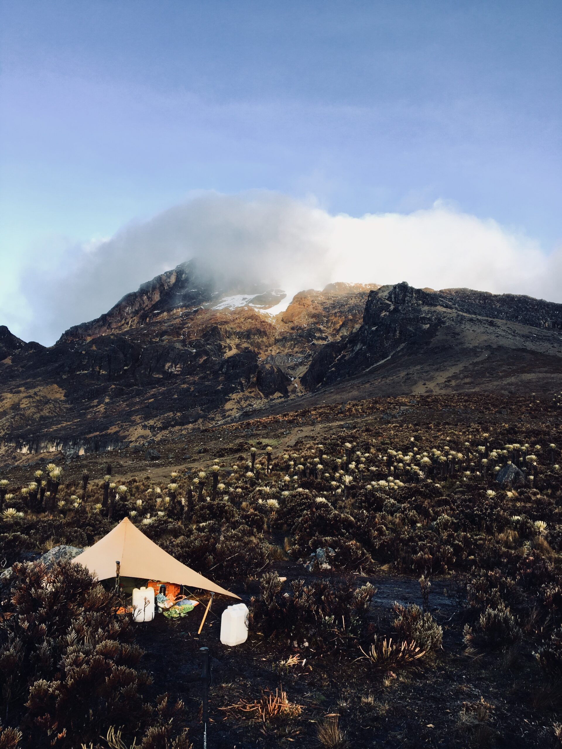
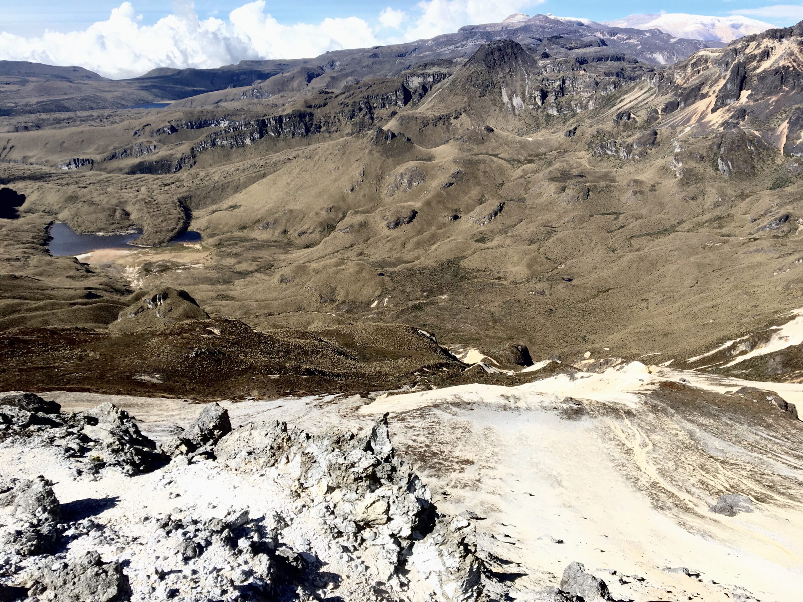
The Day starts very early with our final approach to the mountain. Cold mornings are waiting ahead and our hike have just start. From hilly paths the hike will take around 3 hours before this become steeper and higher. The march get us into the Super – Páramo ecosystem, an scenery arid, a desert left by corrosive action of the ice, ashes and debris left from the past eruption and the so many that have occurred.
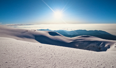
Now over the 5,000m (16.404ft) after the sketchy and exposed scrambling the ice appears, the Team ropes up and push upwards for the final try. summit, located at 5.220m (17.126ft).
Even though the Tolima volcano, is not the most difficult climb you ever achieved, the approach is very demanding and one of the most difficult task of the climb, gaining 1.500m (3.281ft) in a one day.
Back at the farm the day ends with warm dinner,welcoming laughs, and great stories to tell.
Day 3.
Total Distance: 17km
Estimate time: 7 – 8 hours
Altitud gain: 3700m – 4000m – 2400m
From the Primavera farm (3,700m / 12,139ft) the hike starts towards “La linea” pass at 4,000m (13,123ft) and next to La Argentina farm, whit the astonishing views of Paramillo del Quindo or Quindio Volcano, an old structure, big caldera with about 2km in diameter.
We will descent trough the canyon of the “Cardenas” creek, which is the main flowing of the Quindio River; here, the presence of the “Black chested – buzzard eagle” many bird life and the rare and endemic “Rufous fronted parakeet”, having crossed the valley, hiked over Páramo and Sub – Páramo, We will descend in direction of the Argentina farm and later Cocora Valley one of the most visited places in Salento; the corner of biodiversity with over more than 1000 wax palms; home of the Black-and chestnut eagle, hunting and breeding area.
Picked up By the traditional Willys and drop back in your Hostel.
Includes:
• Private transfer from your hostel to Cocora valley and back to town
• Two Dinners, one Breakfast at “La Primavera” farm
• Mules
• Lunch at Estrella de agua reserve
• One Picnic after summit and light breakfast for the summit day
• Snacks for the hike
• Bilingual guide
• Water treatment (When necessary)
• Insurance
• Mountain gear
Not Included:
• Packs
• Rain Gear
HARD: Experience is needed
5: Hikes below 5000m – May need to rope up, use harness and climbing gear – 4 to 6 days of hiking – 8 to 10hrs or more needed – Experience is required at altitud – Fitness and endurance required.
International French Adjectival System (IFAS)
F: facile (easy). Straightforward, possibly a glacial approach, snow and ice will often be at an easy angle.
BOOK NOW
$3,000,000
Book 50%
1
PAX
PRICE PER PERSON
BOOK NOW
$1,800,000
Book 50%
2
PAX
PRICE PER PERSON
BOOK NOW
$1,600,000
Book with 1 payment%
+3
PAX
PRICE PER PERSON

Day 1.
Total Distance: 18km
Estimate time: 7-8 hours
Altitud gain: 2400m – 3800m – 3700m
Distance to Estrella de agua: 7km. / Time: 4 hours
Hike from Cocora Valley through the “San jose” creek to “Estrella de agua”, biological station located at 3,170m (10,400ft); home of 96 species of Birds and mammals as the uncommon Spectacled Bear, Mountain tapir and much more; enjoy lunch on a traditional wood stove with Doña Ludivia, Don Carlos and their son “Juancho”, whom are doing what they love for this place, maintain the tracks and have them in perfect conditions.
Then continue for another 2km inside the humid high Andean forest, this will be the toughest, steepest and muddiest part, until páramo ecosystem at 3,600m (11,811 ft); at this point you will be stock with awe for the quick changes in vegetation; 15min for a quick rest and to get ready for the final push, another 200m (656 ft) to get the highest point for the first day, 3,800m (12,467 ft). Along the ridge of “la virgen ridge” we will hike 5km more, with the views of the two sides of the inter andean valleys; the towering Tolima volcano and the massive Quindio volcano.
Day 2
Total distance: 7km
Distance to High camp: 7km
Estimated time: 5 – 6hrs
Altitud gain: 3700m – 4300m
Early, continue for a short day inside páramo ecosystem, slightly hilly terrain will conduct us through the first slopes of the Tolima volcano. Hike besides “Toche” river; the hike will spot some of the unseen scenarios, like the vast peatlands and extensive marshes. Get the best view of the Toche valley, Cauca valley and the mountain massif complex (Ruiz-Tolima) with all the glaciers in the park; home of the Andean Condor, the Black Chested Buzzard Eagle, the Buffy Helmetcrest hummingbird among others.
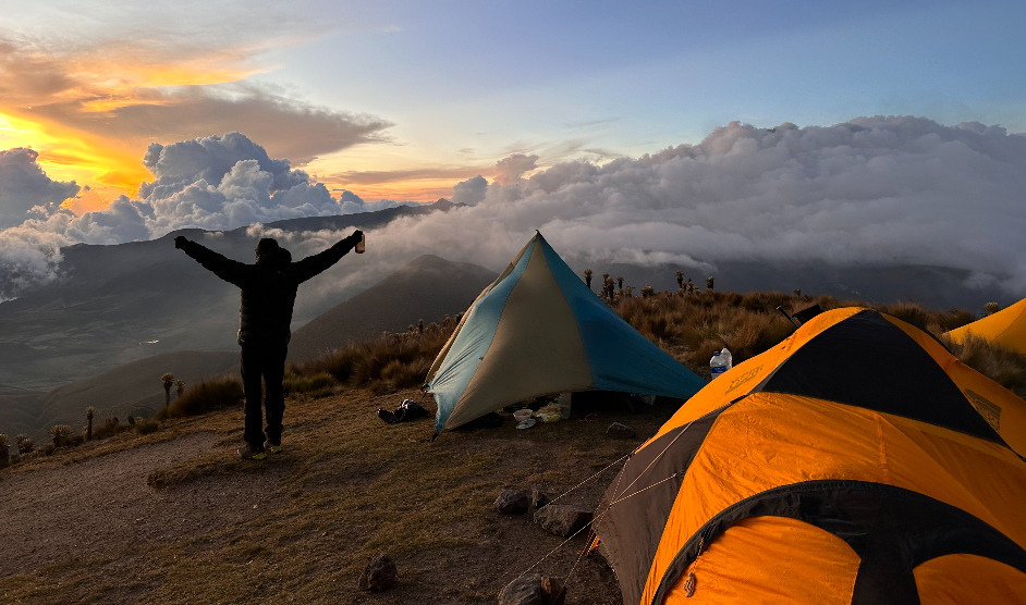
Camp on the upper slopes of the Tolima Volcano and get ready for the Summit day.
Day 3
Total distance: 3km to the Summit and Back to camp / 8km to Next farm
Estimated time: 5hrs to Summit / 4-5hrs to Next Camp
Altitud gain: 4300m – 5220m – 3700m
Over the 5,000m (16.404ft) after the sketchy and exposed scrambling the ice appears, the Team ropes up and push upwards for the final try. summit, located at 5.220m (17.126ft).
The climb on the ice is 200m, at the last bit it is a crevasses field and once cross it, We climb a small cornice and walk till the summit.
Even though the Tolima volcano, is not the most difficult climb you ever achieved, the approach is very demanding and one of the most difficult task of the climb, gaining 1.500m (3.281ft) in a one day.
Back at the farm the day ends with warm dinner,welcoming laughs, and great stories to tell.
Day 4.
Total Distance: 18km
Estimate time: 7 – 8 hours
Altitud gain: 3700m – 4000m – 2400m
From the farm (3,700m / 12,139ft) the hike starts towards “La linea” pass at 4,000m (13,123ft) and next to La Argentina farm, whit the astonishing views of Paramillo del Quindo or Quindio Volcano, an old structure, big caldera with about 2km in diameter.
We will descent trough the canyon of the “Cardenas” creek, which is the main flowing of the Quindio River; here, the presence of the “Black chested – buzzard eagle” many bird life and the rare and endemic “Rufous fronted parakeet”, having crossed the valley, hiked over Páramo and Sub – Páramo, We will descend in direction of the Argentina farm and later Cocora Valley one of the most visited places in Salento; the corner of biodiversity with over more than 1000 wax palms; home of the Black-and chestnut eagle, hunting and breeding area.
Picked up By the traditional Willys and drop back in your Hostel.
Includes:
• Private transfer from your hostel to Cocora valley and back to town
• two dinners and two breakfast at one of the closest farms of Tolima volcano
• Dinner for the pre summit day
• One Picnic after summit and light breakfast for the summit day
• Snacks for the hike
• Bilingual guide
• Water treatment (When necessary)
• Insurance
• Mules
• Mountain gear
Not Included:
• Packs
• Rain Gear
HARD: Experience is needed
5: Hikes below 5000m – May need to rope up, use harness and climbing gear – 4 to 6 days of hiking – 8 to 10hrs or more needed – Experience is required at altitud – Fitness and endurance required
International French Adjectival System (IFAS)
F: facile (easy). Straightforward, possibly a glacial approach, snow and ice will often be at an easy angle.
BOOK NOW
$4,800,000
Book 50%
1
PAX
PRICE PER PERSON
BOOK NOW
$2,600,000
Book with 1 payment
2
PAX
PRICE PER PERSON
BOOK NOW
$2,200,000
Book with 1 payment
+3
PAX
PRICE PER PERSON
⬇️ [Download the program]

Foto: Dazo
TOLIMA-QUINDIO CLIMB 5days
Have more days to consolidate acclimatization – Choose to climb Quindio Volcano
DIFFICULTY: HARD /5/F
Day 1.
Total distance: 10km
Estimated time: 5 – 6 hrs
Altitud gain: 2400m – 3400m
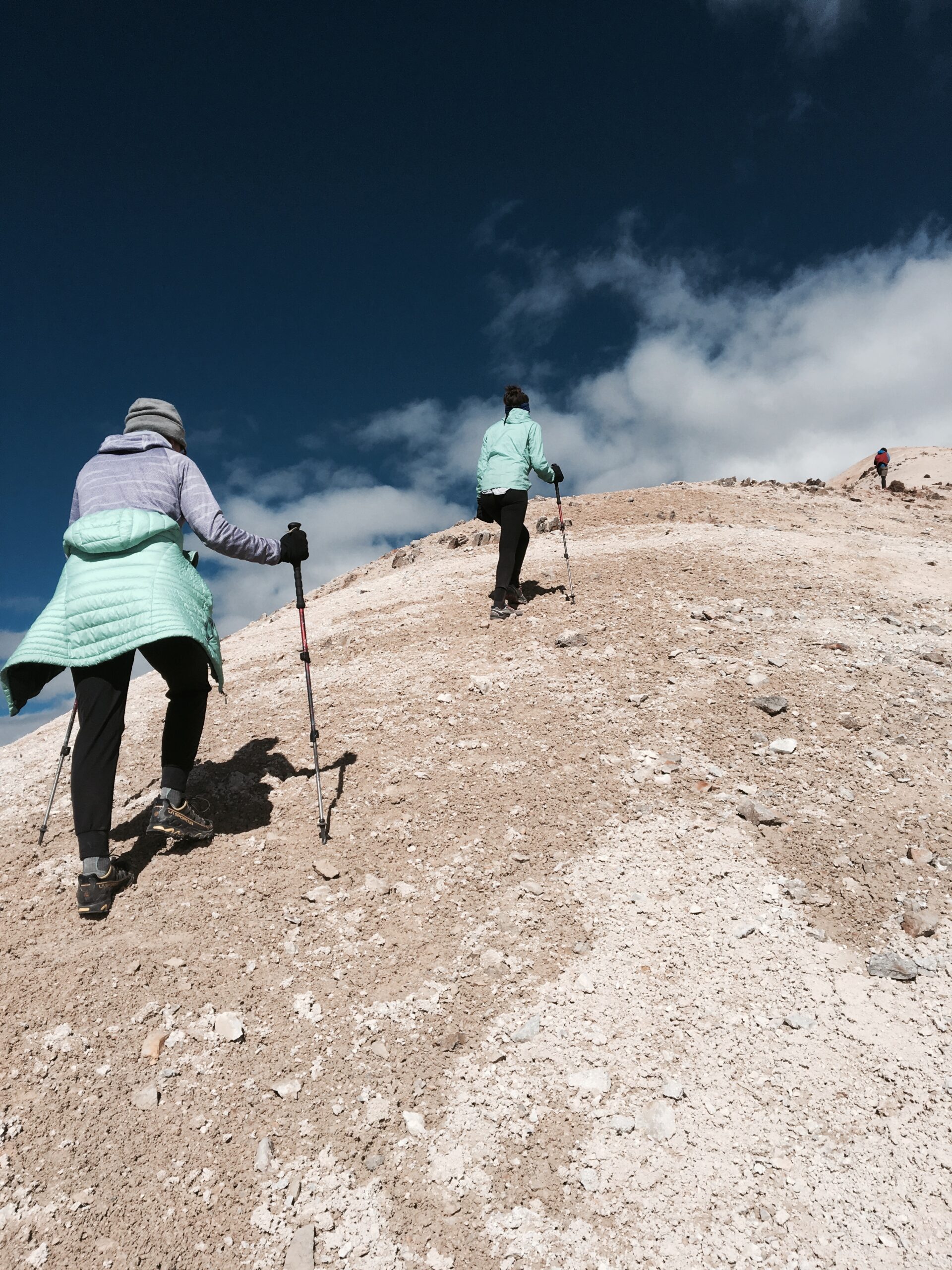
Starting from the Cocora valley 2,400m (7,874ft), one of the most visited places in Salento; the corner of biodiversity; over more than 1000 wax palms; home of the Black-and chestnut eagle, hunting and breeding area. We will ascent trough the canyon of the “Cardenas” creek, which is the main flowing of the Quindio River. Lodging in a traditional milk farm at 3,400m (11,154ft) with a “Salento” family, creator of the extinct “Salentina” potato cultivar.
Day 2
Total distance: 20km
Estimated time: 8 – 10hrs
Altitud Gain: 3400m – 4750 – 3700m
Enjoy the views of the Tolima Volcano, and far away the imposing Quindio Volcano, with Its rare colors and variety of textures your mind will blow up. Within Its direction you will notice many changes in the vegetation; progressively from the bottom of the crater until the arid and silently summit of the Volcano 4,750m (15,583ft); You will get drawn but this giant mountain, composed by the stratification of ashes and small plants of the Super- Páramo ecosystem such as many lichens and Senecio genus within Its many endemism.
Next move towards the farm to get rest and fuel up for the rest of the expedition.
Day 3
Total distance: 7km
Distance to High camp: 7km
Estimated time: 5 – 6hrs
Altitud gain: 3700m – 4300m
Early, continue for a short day inside páramo ecosystem, slightly hilly terrain will conduct us through the first slopes of the Tolima volcano. Hike besides “Toche” river; the hike will spot some of the unseen scenarios, like the vast peatlands and extensive marshes. Get the best view of the Toche valley, Cauca valley and the mountain massif complex (Ruiz-Tolima) with all the glaciers in the park; home of the Andean Condor, the Black Chested Buzzard Eagle, the Buffy Helmetcrest hummingbird among others.
Camp on the upper slopes of the Tolima Volcano and get ready for the Summit day.
Day 4
Total distance: 3km to the Summit and Back to camp / 8km to Next farm
Estimated time: 5hrs to Summit / 4-5hrs to Next Camp
Altitud gain: 4300m – 5220m – 3700m
Over the 5,000m (16.404ft) after the sketchy and exposed scrambling the ice appears, the Team ropes up and push upwards for the final try. summit, located at 5.220m (17.126ft).
The climb on the ice is 200m, at the last bit it is a crevasses field and once cross it, We climb a small cornice and walk till the summit.
Even though the Tolima volcano, is not the most difficult climb you ever achieved, the approach is very demanding and one of the most difficult task of the climb, gaining 1.500m (3.281ft) in a one day.
Back at the farm the day ends with warm dinner,welcoming laughs, and great stories to tell.
Day 5.
Total Distance: 17km
Estimate time: 7 – 8 hours
Altitud gain: 3700m – 4000m – 2400m
From the farm (3,700m / 12,139ft) the hike starts towards “La linea” pass at 4,000m (13,123ft) and next to La Argentina farm, whit the astonishing views of Paramillo del Quindo or Quindio Volcano, an old structure, big caldera with about 2km in diameter.
We will descent trough the canyon of the “Cardenas” creek, which is the main flowing of the Quindio River; here, the presence of the “Black chested – buzzard eagle” many bird life and the rare and endemic “Rufous fronted parakeet”, having crossed the valley, hiked over Páramo and Sub – Páramo, We will descend in direction of the Argentina farm and later Cocora Valley one of the most visited places in Salento; the corner of biodiversity with over more than 1000 wax palms; home of the Black-and chestnut eagle, hunting and breeding area.
Picked up By the traditional Willys and drop back in your Hostel.
Includes:
• Private transfer from your hostel to Cocora valley and back to town
• One dinner and breakfast at La Argentina farm
• two dinners and one breakfast at one of the closest farms of Tolima volcano
• One Picnic after summit and light breakfast for the summit day
• Snacks for the hike
• Bilingual guide
• Water treatment (When necessary)
• Insurance
• Mules
• Mountain gear
• Tents
• Sleeping gear
Not Included:
• Packs
• Rain Gear
HARD: Experience is needed
5: Hikes below 5000m – May need to rope up, use harness and climbing gear – 4 to 6 days of hiking – 8 to 10hrs or more needed – Experience is required at altitud – Fitness and endurance required
International French Adjectival System (IFAS)
F: facile (easy). Straightforward, possibly a glacial approach, snow and ice will often be at an easy angle.
BOOK NOW
$5,800,000
Book 50%
1
PAX
PRICE PER PERSON
BOOK NOW
$3,450,000
Book 50%
2
PAX
PRICE PER PERSON
BOOK NOW
$2,700,000
Book with 1 payment
+3
PAX
PRICE PER PERSON
Do not leave without looking into this!
Gear list
Gear list for trekking – Los Nevados National Park
The mountains at Los Nevados National are humid with constant drizzle rain, fog and mist, sleet and hail. Gear for cold and wet weather is mandatory.
GEAR CHECK LIST
*Please consider taking with you a HEADLAMP.
Clothing:
- Base Layers
- Mid Layer
- Insulating Layer
- Shell Jacket & Pants
- Softshell Pants
- Gaiters
- Warm Hat & Balaclava or Neck Gaiter
- Sun Hat or Cap
- Gloves
- Socks
- Pijamas or something as warmth as a base layer
Footwear:
- Good quality Trekking boots/shoes/trail runners with good traction
- Rubber boots (Good option for muddy conditions)
- Sandals/Crocs/Light shoes for campsites and huts (1 pair)
- Trekking socks (2 pairs minimum in case one pair gets wet)
General Gear:
- Mountaineering Boots
- Crampons
- Ice Axe
- Harness
- Helmet
- Belay Device & Locking Carabiners
- Personal Anchor System or Sling
- Rucksack/Backpack
Food and Water:
- Hydration System/Water Bottles
- High-Energy Snacks
- Meals
Sleeping & Camp Gear:
- Sleeping Bag
- Sleeping Pad
Navigation & Communication:
- Map & Compass
- GPS Device
- Whistle
- Cell Phone
- Personal Locator Beacon (PLB) or Satellite Communicator
Health & Safety:
- Sunglasses
- Sunscreen & Lip Balm with SPF
- First-Aid Kit
- Personal Medications
- Hand Sanitizer & Toilet Paper
- Water Purification Tablets or Filter
Additional Items:
- Trekking Poles
- Headlamp
- Camera or Smartphone
- Knife or Multi-tool
- Ecosystem Specific:
- Waterproof Notebook and Pen
- Insect Repellent
- Lightweight Rain Poncho or Umbrella
Personal Documents:
- ID/Passport
- Health Insurance Card/Details
- Mountain Permits
- Emergency Contact Information